Metadata for Snow Loads for Regulating Structural Design
Identification
- File Name
- RegSnowLoadAreas
- Feature Dataset
- Regulatory Areas
- Ownership
-
District of North Vancouver
355 West Queens Road, North Vancouver, BC, Canada, V7N 4N5
Spatial
- Extents
-
- Coverage
-
West:
Not Applicable
East: Not Applicable
South: Not Applicable
North: Not Applicable - Coordinate System
- Not Applicable
- Projection
- Not Applicable
File Properties
- Data Type
- Feature Class
- Data Format
- ESRI Enterprise SDE
- Geometry Type
- Not Applicable
- Topology
- Not Applicable
- Spatial Index
- Not Applicable
- Linear Referencing
- Not Applicable
History
- Date Posted to GIS:
- 2006
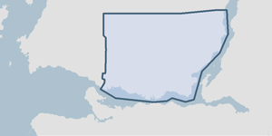
- 2006: Polygons representing regulatory areas for the construction of roof pitches were digitized from specific lines of contour. Planning department staff identified elevation ranges to be digitized.
Quality
- Accuracy
-
- Concurrent with contour lines.
- Spatial information is collected and entered using the best method applicable to this dataset.
- Spatial information is higly accurate and reasonably the best it can be.
- Where multiple collection/entry methods, the more accurate method is predominant throughout this dataset.
- Completeness
-
- Spatial information is known to be complete, expected to be complete or very close to complete.
Maintenance
The Planning department submits a marked-up map to the GIS department. The Snow Loads for Structural Design are adjusted in the GIS as required.
Supporting Documentation
- Data Dictionary
- Not Applicable
- Relationships
- Not Applicable
- Rights
- Terms and Conditions of Use