PDF Maps

Our standard map products, ready for printing

Our standard mapping products are downloadable in Adobe PDF format and are ready for printing. Each map retains its original dimensions, size and scale so that the quality and clarity of every map is preserved.

The Single Maps are printed on one page and depict a single theme covering the entire District, typically at a scale of 1:12,500. These maps will show a large area but with less detail and provide a good overview. Conversely, the Map Sets represent a unique theme and consist of multiple map sheets. Our map sets divide the District into smaller areas, or grids, thereby allowing each map sheet to show more information in greater detail.

Aerial Image Thumbnail

Aerial Image

A large, wall-size (62" x 36"), full colour aerial photography map of the District of North Vancouver. At 300 dpi for excellent viewing and printing, the detail available in this 1:10,000 scale image is equivalent to one metre resolution.
Bikeways Thumbnail

Bikeways

Based off our standard street map, the bikeways map highlights the North Shore bicycle network (streets intended as bike routes). The transit network (streets used by buses) is also highlighted .
Dangerous Goods Route Thumbnail

Dangerous Goods Route

This smaller (11" x 17") sized map illustrates both the primary and alternate routes to which transportation of dangerous goods are restricted while travelling through the DNV.
Development Permit Areas: Creek Hazard Thumbnail

Development Permit Areas: Creek Hazard

This map shows properties next to the creeks and rivers that are at potential risk due to debris flow, debris flood and flood. These areas may be subject to additional regulations and restrictions.
Development Permit Areas: Energy, Water Conserve. & Greenhouse Gas  Reduction Thumbnail

Development Permit Areas: Energy, Water Conserve. & Greenhouse Gas Reduction

The purpose of this Development Permit Area is to complement Councils Green Building Strategy for new buildings to foster the efficient use of energy and water and reduce greenhouse gas emissions. Development in these areas may be subject to additional regulations and restrictions.
Development Permit Areas: Form and Character Thumbnail

Development Permit Areas: Form and Character

The purpose of this Development Permit Area is to guide the form and character of commercial, industrial and multi-family development, and their relationship to the surrounding neighbourhood. Development in these areas is subject to additional regulations and restrictions.
Development Permit Areas: Protection of the Natural Environment Thumbnail

Development Permit Areas: Protection of the Natural Environment

The purpose of this Development Permit Area is to protect the natural features and ecological systems that may be present in these areas. Development in these areas may be subject to additional regulations and restrictions.
Development Permit Areas: Slope Hazard Thumbnail

Development Permit Areas: Slope Hazard

This map shows properties that are near the top or bottom of very steep slopes. Development in these areas may be subject to additional regulations and restrictions.
Development Permit Areas: Streamside Protection Thumbnail

Development Permit Areas: Streamside Protection

This map shows properties next to and within creek corridors. The purpose of this Development Permit Area is to protect the habitat for fish and wildlife and fulfils the District's and property owner's obligation pursuant to the Provincial Riparian Area Regulations. Development in these areas may be subject to additional regulations and restrictions.
Development Permit Areas: Wildfire Hazard Thumbnail

Development Permit Areas: Wildfire Hazard

This map shows the forests at risk for wildfire and the adjacent properties. Development in these areas may be subject to additional regulations and restrictions.
Existing Occupied Purpose-Built Market Rental Properties Thumbnail

Existing Occupied Purpose-Built Market Rental Properties

This map shows the level of rental protection available for existing market rental housing sites in the District that have five or more units.
Garbage Collection Zones Thumbnail

Garbage Collection Zones

A colour coded map of the District of North Vancouver's five waste collection regions, along with this year's calendar indicating which day of the week each zone receives pick-up.
Hydrology Thumbnail

Hydrology

This map illustrates locations and names of all creeks, rivers and water bodies across District. It also indicates the names and boundaries of their respective watershed regions.
Neighbourhoods Thumbnail

Neighbourhoods

This map provides the names and associated regions of all District of North Vancouver neighbourhoods, differentiating them from each other using an assortment of colour shadings.
NRCan Soil Type Thumbnail

NRCan Soil Type

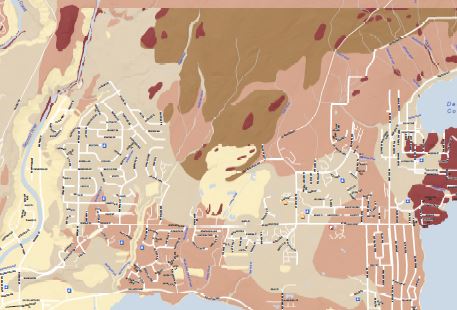
This map indicates the National Earthquake Hazards Reduction Program (NEHRP) soil categories for the District of North Vancouver. NEHRP has defined five soil types based on their shear-wave velocity. Please note that it is intended to convey regional trends and should be used as a guide only; it is not a replacement for site specific geotechnical investigations. This map is a reproduction from the NRCan Risk Map Atlas: https://geoscan.nrcan.gc.ca/starweb/geoscan/servlet.starweb?path=geoscan/fulle.web&search1=R=296254
Official Community Plan - Land Use Thumbnail

Official Community Plan - Land Use

This is the Official Community Plan Land Use map depicting the land use designations described in section 12.5 of the District's Official Community Plan. It is continually updated to include all OCP amendments subsequent to adoption of the OCP in 2011.
Ownership Thumbnail

Ownership

This map presents an general overview of current property ownership categories throughout the District. For more detailed ownership information, please refer to the Ownership Map Series below.
School Catchments Thumbnail

School Catchments

Boundaries illustrating Elementary and Secondary school attendance catchment areas, as well as locations of all primary, secondary, and post-secondary schools in North Vancouver.
Snow Loads for Structural Design Thumbnail

Snow Loads for Structural Design

Due to building bylaw requirements, the snow load elevation ranges illustrated on this map are designed to aid when planning structural design.
Snow Removal Priorities Thumbnail

Snow Removal Priorities

This map illustrates the priority levels assigned to streets in the District of North Vancouver with respect to snow removal. During, and after, a snowfall event streets are ploughed based on these pre-determined classifications.
Streets Thumbnail

Streets

One of two versions of our standard street map, this illustrates North Vancouver streets and an assortment of major facilities and points of interest.
Streets Classification Thumbnail

Streets Classification

This map illustrates North Vancouver streets based on street classification.
Streets with Index Thumbnail

Streets with Index

One of two versions of our standard street map, in addition to the features found on the other version, this map includes an alphabetical listing of street names and associated grid coordinates making it easy to find particular streets.
Topography and Trails - Grouse Area Thumbnail

Topography and Trails - Grouse Area

This map covers the Western portion of the District of North Vancouver. It includes public trails, an elevation profile, 20m contour intervals and a three dimensional hillshade to better display the topgraphical characteristics of the area.
Topography and Trails - Seymour Area Thumbnail

Topography and Trails - Seymour Area

This map covers the Eastern portion of the District of North Vancouver. It includes public trails, an elevation profile, 20m contour intervals and a three dimensional hillshade to better display the topgraphical characteristics of the area.
Zoning Thumbnail

Zoning

A colour coded overview of current zoning areas throughout the District of North Vancouver. For detailed zoning, refer to the Zoning Series below.